Conversion to GeoTIFF
PostWRF provides conversion of a desired variable (polynomial of variables) of WRF output to GeoTIFF format.
For running this capability of PostWRF,it is necessary to have the gdal tool installed:
sudo dnf install gdal
The section corresponding to the GeoTIFF conversion in namelist.wrf must be enabled:
| ============== CONVERT TO GEOTIFF ================ ============================================== Geotiff_ON_OFF = 1 Variable_name_to_Geotiff = rh Geotiff_pressure_level = 700 |
After running postwrf.sh, the converted tif files will be saved in a folder with a name similar to the name of the file selected
The generated GeoTIFF files could be processed and visualized by a GIS software:
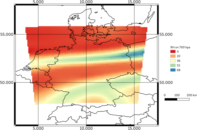
Relative humidity from WRF output at 700hpa, converted to GeoTIFF by PostWRF and visualized by the QGIS software